
Summary of M7.1 Kumamoto Earthquake, Japan
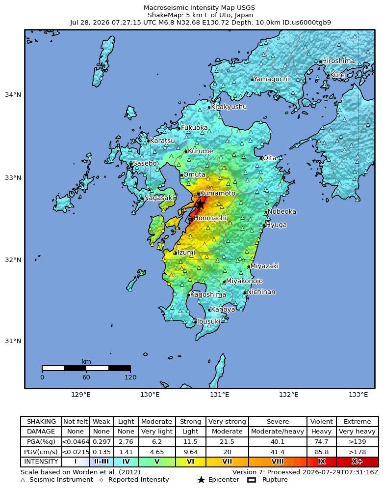
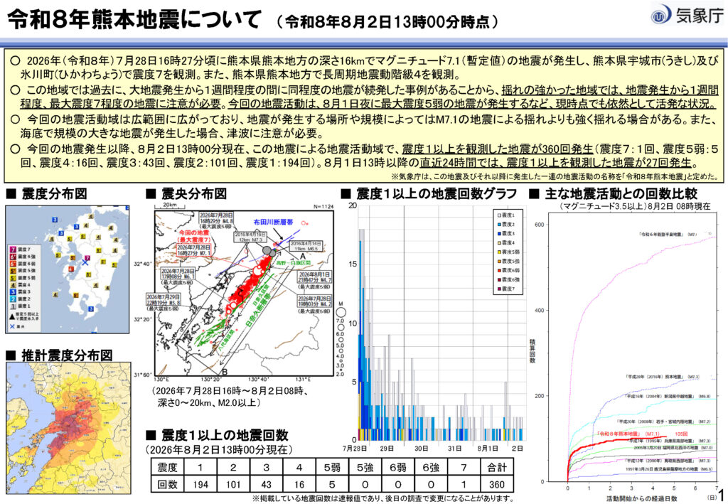
July 28, 2026 – International news outlets and the Japan Meteorological Agency (JMA) reported a powerful 7.1 magnitude earthquake occurring at 16:27 (local time in Japan). The epicenter was located at a shallow depth of just 10 kilometers beneath Kumamoto Prefecture on Kyushu Island, triggered by movement along the Hinagu Fault.
The quake registered a maximum seismic intensity of Shindo 7 in Uki City and Hikawa Town, generating Class 4 Long-Period Ground Motion. Over 200 aftershocks followed the main shock.
Key Impacts on Affected Areas
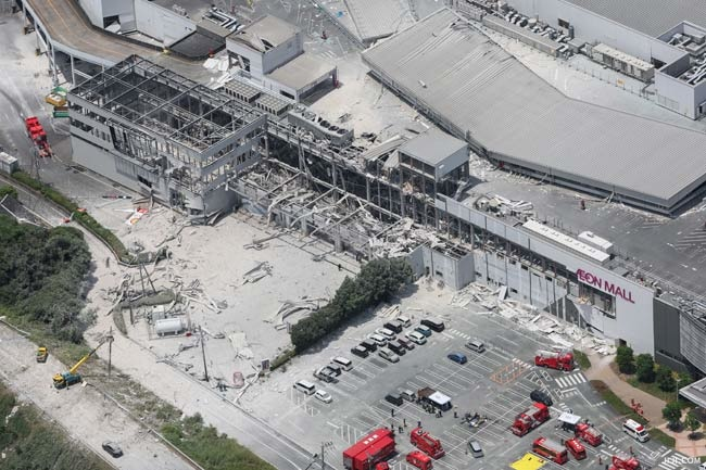
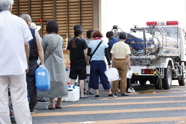
- Loss of Life and Property: Structural collapses caused fatalities, injuries, and missing persons, including an explosion at Aeon Mall Kashima and a fatal incident at the Nippon Paper Yatsushiro Mill. Following the disaster, severe summer heat combined with acute tap water and electricity shortages to critically heighten the risk of heatstroke.
- Transportation Infrastructure: Surface rupture along the fault line occurred beneath the elevated structure at the Kyushu Expressway interchange, causing partial pier settlement and differential cracking. Consequently, authorities closed main highways to traffic and suspended railway operations to inspect structural integrity.
- Public Utilities: Power outages affected over 48,000 households, while main water pipelines ruptured at multiple locations, disrupting tap water supply to more than 84,000 households.
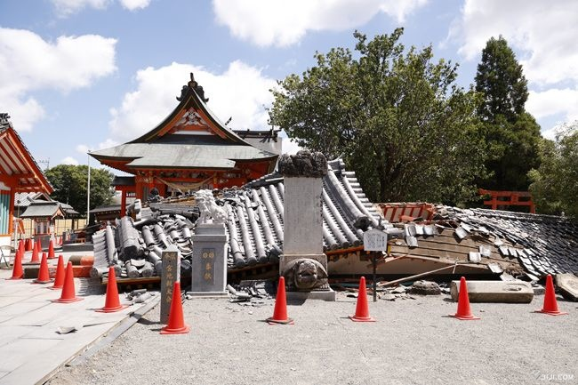
- Buildings and Historical Sites: Inspections revealed structural damage to commercial building walls and collapsed construction debris. Additionally, seismic tremors damaged the stone walls of Kumamoto Castle, which was undergoing restoration.
Post-Disaster Perspective
While the powerful earthquake shook the entire city, damaging buildings and roads... what was it that held the bridge girders in place and prevented them from collapsing? Join us as we decode the safety technologies that helped protect lives in Kumamoto.
📖 Find out together in our in-depth article: "Why Don't Japanese Bridges Fall? How Safety Tech Saved Bridges in the Kumamoto Earthquake" on the EJEC Thailand website - Coming soon
- Japan Meteorological Agency (JMA): 令和8年熊本地震の概要 (JMA Disaster Report PDF) – Meteorological data: M7.1, Shindo 7 intensity, Class 4 Long-Period Ground Motion, and aftershock statistics.
- Nippon.com: Kumamoto Earthquake Damage Report – Public utility damage statistics: 48,000 household power outages, 84,000 household water disruptions, and casualty reports.
- The Guardian: Japan Earthquake Death Toll and Aftershocks Coverage – Coverage on Kyushu Expressway impacts, transit closures, and damage to historical heritage sites.
- Jiji Press (時事通信社): 死亡12人、心肺停止6人 イオンと日本製紙工場で死者8人 – Casualty reports from structural collapses, explosion at Aeon Mall Kashima, Nippon Paper Yatsushiro Mill incident, tap water shortages, and heatstroke risks.
- Jiji Press Photo Feature (時事通信社): 熊本地震(2026年7月) 写真特集 – Photo feature showcasing commercial building structural damage and fallen debris in central Kumamoto City.
- NHK News / X (Twitter): Aerial video from NHK helicopter recording the elevated Kyushu Expressway near Yatsushiro IC – High-angle footage showing vertical displacement and faulting at the girder joints of the elevated highway.